Development and Application of Hyperspectral Image Technology
Abstract: Hyperspectral image technology, as an advanced remote sensing technology, has achieved significant development and widespread application in many fields in recent years. This article introduces the principles and characteristics of hyperspectral images in detail, discusses in depth its applications in agriculture, environmental monitoring, geological exploration and other fields, and looks forward to future development trends.
1. Introduction
With the continuous advancement of science and technology, hyperspectral image technology plays an increasingly important role in many fields with its unique advantages. Hyperspectral images can not only provide rich spatial information, but also obtain fine spectral information, providing strong support for target identification, classification and quantitative analysis.
2. Principles and characteristics of hyperspectral images
(1) Principle
Hyperspectral images are composed of a series of continuous narrow-band images, each band corresponding to a different wavelength range. By measuring the reflection, radiation and other characteristics of the target object at different wavelengths, the target's spectral characteristic curve can be obtained. These spectral characteristic curves contain physical, chemical and other characteristic information of the target and can be used for target identification and classification.
(2) Features
High spectral resolution: able to distinguish small spectral differences and provide richer spectral information.
Multi-band information: Contains dozens or even hundreds of bands, which can comprehensively reflect the characteristics of the target.
The combination of spatial information and spectral information: it can not only obtain the spatial distribution of the target, but also understand its spectral characteristics.
Non-contact measurement: No need to contact the target object, long-distance and large-area monitoring can be achieved.
3. Applications of hyperspectral images in various fields
Crop monitoring: It can monitor the growth status of crops, pests and diseases, etc., and provide decision-making support for precision agriculture. For example, by analyzing the spectral characteristics of crops, the nutritional status of crops can be judged, and fertilization and irrigation can be carried out in a timely manner.
Soil analysis: It can quickly detect soil composition, fertility, etc., providing a basis for soil improvement and rational fertilization.
Agricultural product quality testing: It can be used to detect the maturity, quality and other indicators of agricultural products to improve the quality and market competitiveness of agricultural products.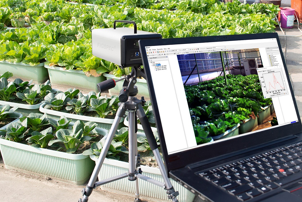
(2) Environmental monitoring field
Water quality monitoring: By analyzing the spectral characteristics of water bodies, the content of pollutants and algae growth in the water can be detected to provide technical support for water resources protection.
Atmospheric monitoring: It can be used to monitor the concentration of pollutants, aerosol distribution, etc. in the atmosphere, and provide data for atmospheric environmental quality assessment.
Ecological environment monitoring: It can monitor vegetation coverage, biodiversity, etc., and provide scientific basis for ecological environment protection and sustainable development.
(3) Geological exploration field
Mineral exploration: Hyperspectral images can be used to identify the spectral characteristics of different minerals and quickly and accurately explore mineral resources.
Geological disaster monitoring: It can monitor geological disasters such as landslides and debris flows to provide information for disaster early warning and prevention.
4. Development trends of hyperspectral imaging technology
(1) Higher spectral resolution and spatial resolution: With the continuous advancement of technology, the spectral resolution and spatial resolution of hyperspectral images will continue to improve, able to provide more refined target information.
(2) Real-time monitoring and rapid processing: Develop real-time monitoring technology to achieve rapid response and processing of targets and improve the timeliness of monitoring.
(3) Multi-source data fusion: Fusion of hyperspectral images with other remote sensing data, geographical information data, etc. to improve the accuracy of target recognition and classification.
(4) Intelligent application: Combining artificial intelligence, machine learning and other technologies to realize automatic analysis and processing of hyperspectral images and improve work efficiency.
5. Conclusion
As an advanced technology with broad application prospects, hyperspectral image technology plays an important role in agriculture, environmental monitoring, geological exploration and other fields. With the continuous development and improvement of technology, hyperspectral image technology will be widely used in more fields and make greater contributions to the development and progress of human society.


